| ©The Archaeological Settlements of Turkey - TAY Project | ||||||
|
|
||||||
Myndos |
||||||
|
|
||||||
| Ages | Maps | Photos | ||||
| IA Greek-Roman |
 |
 |
||||
|
|
||||||
|
Type:
|
City | |||||
|
Altitude:
|
m | |||||
|
Diameter:
|
m- Direction: | |||||
|
|
||||||
|
Region:
|
Aegean | |||||
|
Province:
|
Mugla | |||||
|
District:
|
Bodrum | |||||
|
Village:
|
Gümüslük | |||||
|
|
||||||
|
|
||||||
|
|
||||||
|
TAYEx:
|
- | |||||
|
|
||||||
|
Registration State:
|
Registered For detailed registration information please refer to Turkish pages. | |||||
 |
||||||
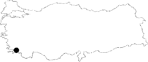
| Location: It is located within the borders of Gümüslük in the Bodrum District of Mugla. It is one of the Carian cities referred in the ancient geography [Sahin 2006:171]. |
| Geography and Environment: Myndus is located on the Cape Termerium near Halicarnassus, opposite to the Cape Scandaria of Kos Island as described by Strabo. Gümüslük is a peninsula with a high western promontory, and the narrow strait connecting it with the mainland was separated with a corridor during the earlier periods. The area linking Myndus with Halicarnassus included several fertile and rich valleys, windmills on mutual slopes of these valleys and subordinate settlements [Sahin 2006:171]. |
| Destruction Details: |