|
©The Archaeological Settlements of Turkey - TAY Project
|
|
|
|
|
|
Myndos |
|
|
For site maps and drawings please click on the picture... 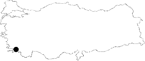 |
For photographs please click on the photo...  |
|
Type:
|
City |
|
Altitude:
|
m |
|
Region:
|
Aegean |
|
Province:
|
Mugla |
|
District:
|
Bodrum |
|
Village:
|
Gümüslük |
|
Investigation Method:
|
Excavation |
|
Period:
|
|
|
|
|
 |
|
| Location: It is located within the borders of Gümüslük in the Bodrum District of Mugla. It is one of the Carian cities referred in the ancient geography [Sahin 2006:171]. |
| Geography and Environment: Myndus is located on the Cape Termerium near Halicarnassus, opposite to the Cape Scandaria of Kos Island as described by Strabo. Gümüslük is a peninsula with a high western promontory, and the narrow strait connecting it with the mainland was separated with a corridor during the earlier periods. The area linking Myndus with Halicarnassus included several fertile and rich valleys, windmills on mutual slopes of these valleys and subordinate settlements [Sahin 2006:171]. |
| History: |
| Research and Excavation: Modern investigations about the city were mainly carried out from 1800s by travellers, who even reported remains of a theatre and a stadium during that period, which unfortunately didn't survive to the present day. Again during the 19th century W.R. Paton and J.L. Myres visited the city, mostly examining the inscriptions. Fr. Beaufort collected his notes of excursions and surveys in Anatolia in 1811 in a work called Karamania, and identified a breakwater at the entrance of the Gümüslük Harbor and some remains in the front part of the bay. In 1850s, several cut stones were observed on the slopes, with some extramural graves noticed. The number of inscriptions was limited. C.T. Newton, who surveyed Myndus and its neighbouring reports a temple, a big church and baths on the coastal plain of the harbor. In 1950s, G.E. Bean visited the city. Excavations were initiated in 2005 by M. Sahin of the Uludag University, and Y. Yildiz of the Bodrum Museum of Underwater Archaeology. Since 2006 campaign, the excavations have been completely taken over by the Archaeology Department of the Uludag University [20.uludag.edu.tr/~arkeoloji/myndos.htm 5.6.2007 11:20]. It takes place in the registered archaeological sites list prepared by Ministry of Culture and Tourism. |
| Stratigraphy: |
| Small Finds: Statue/Relief: The artifact which was claimed to be found in the Gümüslük Village and delivered to the museum in 1964 is a torso of an Archaic kouros made of coarse grained grey marble, which is 56.5 cm in height and 28.5 cm in width, with the upper part of his body and legs below his knees missing [Gürman 1974b:53]. City Wall: Entirely made of granite, the southern section of the city wall was built over the elevation resulted from removed soil, and it was reinforced with towers. The walls on the northeastern and northwestern sections strecth in accordance with the topography of the terrain on a natural rocky ridge. The pseudo-isodomic city wall consisted of rubble stones between the two walls, with a thickness reaching up to ca. 2.2 m. Lintels were used at some places, mid-sections faced with bossages [Tirpan 1988: 168-170]. |
| Remains: |
| Interpretation and Dating: |