|
©The Archaeological Settlements of Turkey - TAY Project
|
|
|
|
|
|
Myndos |
|
|
For site maps and drawings please click on the picture... 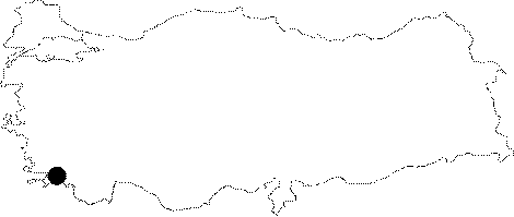 |
For photographs please click on the photo...  |
|
Type:
|
City |
|
Altitude:
|
m |
|
Region:
|
Aegean |
|
Province:
|
Mugla |
|
District:
|
Bodrum |
|
Village:
|
Gümüslük |
|
Investigation Method:
|
Excavation |
|
Period:
|
Classical Hellenistic Roman |
|
|
|
 |
|
| Location: It is located within the borders of Gümüslük in the Bodrum District of Mugla. It is one of the Carian cities referred in the ancient geography [Sahin 2006:171]. |
| Geography and Environment: Myndus is located on the Cape Termerium near Halicarnassus, opposite to the Cape Scandaria of Kos Island as described by Strabo. Gümüslük is a peninsula with a high western promontory, and the narrow strait connecting it with the mainland was separated with a corridor during the earlier periods. The area linking Myndus with Halicarnassus included several fertile and rich valleys, windmills on mutual slopes of these valleys and subordinate settlements [Sahin 2006:171]. |
| History: Myndus which was inhabited by Lelegians [Strabo 13; 1; 59] was a member of the Delian League during the 5th century BC; and paid only one twelfth of a talent as tribute. Although Pausanias [Pausanias 2; 30; 9] states that Myndus was founded by people from the dynasty of Aetios; the king of Troezen; Bean thinks that this was pure imagination [Bean 2000:112]. It is known she paid a tribute of 1/12 talent to the Delian League between 453 and 420 BC. In spite of the fact that other Lelegian cities were forced to move to Halicarnassus during the Mausolus' period; Myndus; along with Theangela was the exception. Besieged by Alexander the Great in 334 BC; it was conquered one year later by his commander in chief; Orontobades. Myndus was under the hands of Ptolemies between 308-275 BC; followed by Lysimachus Dynasty in c. 200 BC. While under the protection of Rhodes in 197 BC; the city became independent and minted her first coins. Then; she was incorporated to the Kingdom of Pergamon; and they recognized the power of Rome in 133 BC [Tirpan 1988:168]. It is known that a rebel named Aristonichus took control of the city for a short period of time in 131 BC [Bean 2000:113]. Cassius prepared his navy for war in Myndus in 43 BC. According to an inscription found in the island of Kos; the city organized Apollo festivities. It was part of the Caria Eparchy during the Byzantine period; and called Amyndos. |
| Research and Excavation: Following the excursions and researches by Paton and Myres in the 19th century; Newton; and then Bean conducted several researches in the city. Paton and Myres claimed that there was no settlement belonging to Lelegians; however Bean stated that the Lelegian Myndus is located 3 km southeast of Gumusluk on the Bozdag Hill (see Bozdag-Erentepe) [Tirpan 1988:168]. The excavations started under the leadership of M. Sahin by the Bodrum Nautical Museum of Archaeology during 2005 became excavations performed through the legislative decree by the Government of Turkey [Sahin 2008:21]. It takes place in the registered archaeological sites list prepared by Ministry of Culture and Tourism. |
| Stratigraphy: |
| Small Finds: |
| Remains: Even tough not referred in any of the ancient resources; Bean suggested that there used to be silver mines in the vicinity of Myndus; and that is why the contemporary settlement is called Gumusluk (a form of silver in Turkish). He reported that Myndus where Lelegians lived was at Bozdag; 3.2 km to the southeast of Gumusluk; and there was potsherds dating from the prehistorical ages to the 4th century BC. It is known that Myndians produced wine; but they had a bad reputation as they mixed it with salty water from the sea [Bean 2000:112-113]. City Wall: The southern part of the all-granite wall was built on top of an excavated soil elevation; and was supported by towers while the northeastern and northwestern walls rise on a natural rock; and continue in accordance with the land. The wall which disappears following its connection to a tower close to the seashore; is presumed to have been originally connected with the harbor after adding the west peninsula within its borders. The main gate was presumably located to the south. The pseudo-isodomic city wall; 2.2 m in width; consist of rubble stones between two walls. Partially lentil stones were used; and the mid-sections were arranged in embossments [Tirpan 1988:168-170]. The wall stones were probably transported from the quarries in Koyunbaba; 3 km to the north [Bean 2000:114]. The square planned towers measuring 5x5 m were built with a pseudo-isodomic masonry. The extant towers measure approximately 1.5 m in width. The tower called Tepe Kulesi is slightly different than the others; measuring 8.8x22.1 m; it is divided into two sections by a wall. A door in the exterior section provides exit to outside the wall. The interior section is higher than the exterior one to protect the tower. Although there are no remains of the gate; it is thought that the gate was probably to the north over the path [Tirpan 1988:170]. Overall; the city wall of Myndus was built with homogenous material and technique. The researchers suggest that the walls can be dated to the 4th century BC; based on its characteristics. The ancient authors also stated that the Myndus walls were built during the reign of Mausolus [Tirpan 1988:170-171]. Altar: In 2006 yılında; researches were performed on the platform which probably was the center of the settlement made by leveling the bedrock which contains the building remains that possibly belonged to the altar. It is assumed that the wall remains that surround the altar on the bedrock inside the trench ÔC' from the western direction belonged to the temenos wall. The wall which measured 40 cm in thickness was constituted by irregular embossed large stones in different width. A section of the wall which is 15.5 m long was unearthed and its height differs between 65-140 cm depending on the height of the bedrock. During the researches inside the trench ÔK' which were performed to unearth another wall which can be observed on the ground; and cuts this wall in right angle; towards the altar. These researches unveiled that the upper sections of the wall built in north-south direction; and the one that continues in east-west direction have different characteristics in comparison to each other. The north-south wall researched inside the trench ÔK' is wide and high; but it consists of somewhat narrow trimmed stones. The internal surfaces of the wall contain regular embossments which expand towards the bottom. The external surfaces were finished smoothly but they are slightly rough. The wall section that continues in parallel with the wall revealed inside the trench ÔC' (or trench east-west) also shows the characteristics of the wall inside the trench ÔC' which is mainly embossed; thick cut stones. With these characteristics; the two walls in parallel actually show the characteristics of two walls of the same building. Another wall that shows the same characteristics was revealed; where the bedrock is observed in front of the wall that continues in north-south direction; on the east of the trench. These possibly are not related with the altar but another building. Inside the trench ÔL' which was opened at the intersection of the trenches ÔC' and ÔK' the corner of to large blocks was found 97 cm underneath the surface. The researches that were performed on the west side of the altar overlooking the sea; continued in the area where the section made inside the bedrock ends which gives the impression of steps based on its view from on the ground. A floor made by leveling the bedrock surface was revealed here; underneath the course of rubble stones that consists of scattered and middle size irregularly shaped stones. During the researches performed inside other sections of the altar it was observed that the altar was used and renovated during different phases; and the floor was covered by a floor mosaic that consists of geometric figures [Sahin 2008:21-25]. Workshop: The traces of pavement on a low slope to the east of the village road; and the remains of rock basins suggest a wine production workshop [Diler 1995a:441]. Quarry: The ancient quarry located at the Koyunbaba bay in Gümüslük; Bodrum displays the view of a quarry that was in use throughout very long years. When compared to the samples taken from the ancient city of Myndos; it became certain that the stone used in the construction of the buildings at Myndos were definitely brought from Koyunbaba quarry[(Baskaya; H.S. - S. Dirim) Sahin 2008: 30-31]. Structure With Unknown Function: Some walls are found at the hilltop of the peninsula. Some polygonic; some of cut stone blocks; these walls are approximately 1.2 m wide; consisting of two blocks of stones. This is typical of Lelegian masonry [Tirpan 1988:171]. Miscellaneous: Fragment of a statue which lacks up the waist; and below the knees which was uncovered in the Gumusluk Village; and which is already preserved at the Museum of Bodrum was compared against the torsos in Samos; Eleusis and Miletus; and consequently dated to the Archaic Period; probably to 550-530 BC [Gurman 1974b:53]. During the excavations in 2006 sherds were found at different levels: the fragment of a black varnished open vessel from Hellenistic Period was found at -49 cm; the fragment of a kantharos jug handle dated to 4th century BC was found at -236cm inside the sounding ÔC'; a Hellenistic; terra cotta; decapitated man figurine was found at -177 cm; a row of columns in Doric order was found on the northern border of the trench ÔG' (a lower fragment of a column and its stylobat were found in situ) [Mert;I.H.) Sahin 2008:25-27]. A waterpipe system made of terra cotta covered with mortar that may belong to the Roman Period was found below the late period walls level in 2006 at the location which is assumed to be a Hagiasma from Christianity Period. Cut stones were used underneath the waterpipe system as a support; and these stones were placed on the floor made of rubble stones. It is assumed that the patch made of a course of cut stones in the same axis with the waterpipe right north of the system were meant for repairing the blown section of the waterpipe [(Sahin; D.) Sahin 2008:27-30]. During the 2011 studies, a room with a length of 5.16 m, the edges of which are clear and its door opens to the north, was discovered in Trench C1. The wall on the narrow sections is slightly convex. At the entrance, there is a floor pavement built with compressed lime. The room yielded an honor wreath, a fragment of figurine belonging to Artemis, a great number of metal nail and tile fragments and three coins. Potsherds belonging to Late Classical and Hellenistic periods were found in high density in the room fill. Sherds belonging to a megarian bowl with Eros motif were recovered. The city wall borders the west section of the trench. There is a green sandstone doorstone with a dimension of 0.80x0.42x0.12 m on the east edge of the wall. In front of the doorstone, a floor with a dimension of 0.80x1.08x0.08 m built with marble slabs is located. No fill consisting potsherds belonging to Late Classical and Hellenistic periods was encountered in the pits opened into the bedrock on the southwest corner of Trench C2. The wall foundation built with the early period material, as the ones used in the doorstone, was found on the southwest edge of the trench. The floor paved with baked clay slabs with a dimension of 0.25x0.25 cm and a height of 0.03 m was discovered on the northern border of the extended section of the trench. Among the finds recovered from Trench C2, there are black glazed vessels belonging to 5th and 4th century BC., Megarian bowl sherds, Hellenistic plain common wares and amorphous vessels. Five steps descending to the west were discovered in the west section of Trench D1-A. These steps continue downward to the door of the room in C1. West section of the stairs is bordered with a wall and a cistern limits the south section. There are three protuberances look like stairs on the east wall of the cistern. A room with a dimension of 3.16x3.60 m, which could be a cellar, was found on the north of the stairs. The wall of the room is preserved up to 1.70 m. The stairs should provide an access to this room. There is a corridor in which an in situ amphora was found on the east of the stone that was used as a step. The corridor opens to the larger main room via a door with doorstone in 0.44 m width. This main room yielded an in situ base sherd belonging to a storage vessel, sherds belonging to a large pithos and a ground stone. To the south of the room, some parts of the floor were covered with baked clay slabs with a dimension of 0.44x0.44x0.94 m. The other parts of the floor were smoothed with compressed soil. Among the finds recovered, there are lids belonging to 2nd and 3rd century BC., Late Roman lamps, an amphora with concave base, pedestals belonging to common wares, sherds, the external surfaces of which black glazed and the internal surfaces are brown glazed, belonging to the local wares, Byzantine lids and pans. A room surrounded with mud mortar and rubble stones was exposed in Trench D1-B. Two floors plastered with lime were found on the south and north of the room. The room located on the south measures 1.25x0.97 m and the depth is about 0.35 m. The one on the north is 1.10x1.36 m in dimension and the depth is 0.36 m. These two unrelated floors indicate that there could be a workshop here. There are sherds belonging to Hellenistic, Roman Imperial and Late Roman periods and a pithos among the finds recovered [Sahin 2013:25-30]. During the studies carried out behind the tower, two rooms, the walls of which are partially preserved, and two cisterns were exposed. Among the finds recovered from several layers, there are coarse common wares and fine potsherds dated to 4th century BC. and Late Antiquity [Sahin 2013:36]. The 2012 excavations continued on Asar Island. The studies were carried out in three different soundings made in order to understand the architecture of the middle terrace of the island. The studies yielded pottery sherds belonging to Hellenistic, Late Roman and Byzantine periods [Sahin 2014]. The inscription found in Trench F5A in 2013 provides data about the Pre-Christian identity of Asar Island. The Roman Emperor Trajan who lived in the 1st century AD dedicated the inscription to Apollo Archigetes for his father. This inscription indicates that the island was the sacred area of Apollo Archigetes before Christian Period. The architectural elements found on the surface should belong to a monumental gate rather than a temple [Sahin 2015]. |
| Interpretation and Dating: Many marble blocks found during the excavations carried out in the area called Terrace I in 2009 shows that this area is first inhabited during 4th Century BC [Sahin [Sahin, D. -Dumankaya) 2011:160]. |