| ©The Archaeological Settlements of Turkey - TAY Project | ||||||
|
|
||||||
Alabanda |
||||||
|
|
||||||
| Ages | Maps | Photos | ||||
| IA Greek-Roman |
 |
 |
||||
|
|
||||||
|
Type:
|
City | |||||
|
Altitude:
|
m | |||||
|
Diameter:
|
m- Direction: | |||||
|
|
||||||
|
Region:
|
Aegean | |||||
|
Province:
|
Aydin | |||||
|
District:
|
Çine | |||||
|
Village:
|
Doganyurt | |||||
|
|
||||||
|
|
||||||
|
|
||||||
|
TAYEx:
|
- | |||||
|
|
||||||
|
Registration State:
|
Registered For detailed registration information please refer to Turkish pages. | |||||
 |
||||||
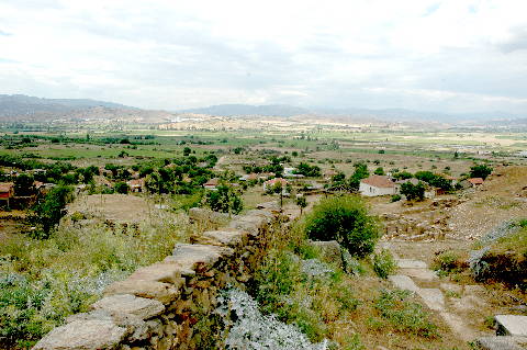
| Location: It is located where the Doganyurt Village; formerly Araphisar; is situated; 7 km west of the Çine District of the Aydin Province [Tirpan 1990a:171]. |
| Geography and Environment: Strabo records that Alabanda was situated in the saddle of two elevations; resembling a donkey with panniers [Strabo 14; 2; 26]. The city was founded at the skirt of the hills extending to a plain. |
| Destruction Details: |