| ©The Archaeological Settlements of Turkey - TAY Project | ||||||
|
|
||||||
Karaca Hirbet Ali |
||||||
|
|
||||||
| Ages | Maps | Photos | ||||
| Neolithic Chalcolithic |
 |
 |
||||
|
|
||||||
|
Type:
|
Mound | |||||
|
Altitude:
|
200 m | |||||
|
Diameter:
|
m- Direction: | |||||
|
|
||||||
|
Region:
|
Mediterranean | |||||
|
Province:
|
Hatay | |||||
|
District:
|
Reyhanli | |||||
|
Village:
|
||||||
|
|
||||||
|
|
||||||
|
|
||||||
|
TAYEx:
|
Visited - 16/7/2001 | |||||
|
|
||||||
|
Registration State:
|
For detailed registration information please refer to Turkish pages. | |||||
 |
||||||
| Location: This site lies 34 km northeast of the city of Antakya; 3.5 km north of the town of Reyhanli and very close to the Turkish-Syrian border. |
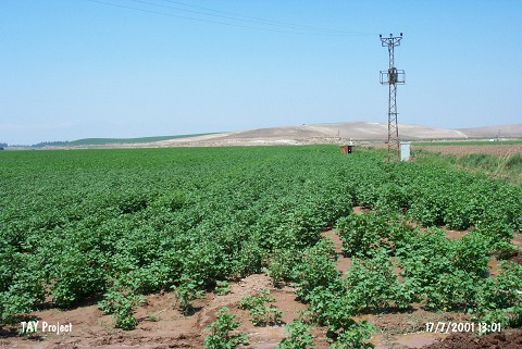
| Geography and Environment: The site is located on the northern bank of Afrin Stream; 300 m from the stream and southwest of the Kürt Mountains. The soil surrounding the mound is fertile. Afrin Stream; which springs from the Kürt Mountains; flows through the Amuq Plain before it empties into Lake Antioch. |
| Destruction Details: |