| ©The Archaeological Settlements of Turkey - TAY Project | ||||||
|
|
||||||
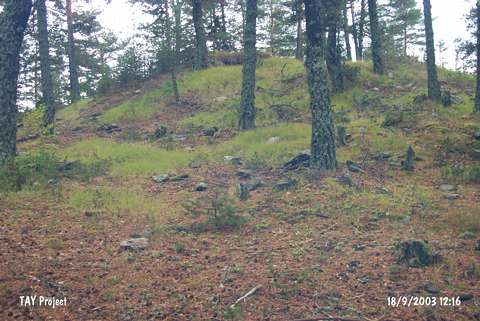
Islamtepe |
||||||
|
|
||||||
| Ages | Maps | Photos | ||||
| Chalcolithic EBA |
 |
 |
||||
|
|
||||||
|
Type:
|
Mound | |||||
|
Altitude:
|
1460 m | |||||
|
Diameter:
|
m- Direction: | |||||
|
|
||||||
|
Region:
|
Black Sea | |||||
|
Province:
|
Kastamonu | |||||
|
District:
|
Tasköprü | |||||
|
Village:
|
Dagbelören | |||||
|
|
||||||
|
Destruction :
|
Illicit Digging - Attention | |||||
|
|
||||||
|
TAYEx:
|
Visited - 18/9/2003 | |||||
|
|
||||||
|
Registration State:
|
Registered For detailed registration information please refer to Turkish pages. | |||||
 |
||||||
| Location: |
| Geography and Environment: |
| Destruction Details: The upper part and the skirts of the settlement have been severely damaged during illicit diggings [TAYEx 18.9.2003]. |