|
©The Archaeological Settlements of Turkey - TAY Project
|
|
|
|
|
|
Islamtepe |
|
|
For site maps and drawings please click on the picture...  |
For photographs please click on the photo... 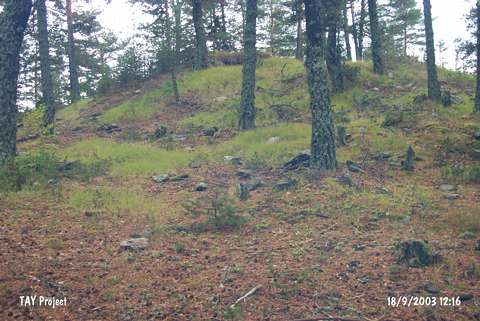 |
|
Type:
|
Mound |
|
Altitude:
|
1460 m |
|
Region:
|
Black Sea |
|
Province:
|
Kastamonu |
|
District:
|
Tasköprü |
|
Village:
|
Dagbelören |
|
Investigation Method:
|
Survey |
|
Period:
|
|
|
|
|
 |
|
| The mound is located north-northwest Dagbelören village; south of Tasköprü district of Kastamonu. It was discovered during the Kastamonu Survey conducted by A. Özdogan; C. Marro and A. Tibet in 1996. The finds from the surface date to the Chalcolithic Age and EBA 2-3. The location code of the site is C 33 / 15. It takes place in the registered archaeological sites list prepared by Ministry of Culture and Tourism. |
| Location: |
| Geography and Environment: |
| History: |
| Research and Excavation: |
| Stratigraphy: |
| Small Finds: |
| Remains: |
| Interpretation and Dating: |