| ©The Archaeological Settlements of Turkey - TAY Project | ||||||
|
|
||||||
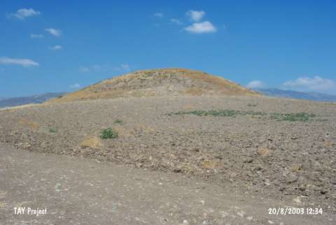
Aliaga Pinari |
||||||
|
|
||||||
| Ages | Maps | Photos | ||||
| EBA IA |
 |
 |
||||
|
|
||||||
|
Type:
|
Mound | |||||
|
Altitude:
|
725 m | |||||
|
Diameter:
|
155 m- Direction: NE-SW | |||||
|
|
||||||
|
Region:
|
Black Sea | |||||
|
Province:
|
Amasya | |||||
|
District:
|
Merzifon | |||||
|
Village:
|
Alicik | |||||
|
|
||||||
|
Destruction :
|
Illicit Digging - Highways, roads, bridges etc. | |||||
|
|
||||||
|
TAYEx:
|
Visited - 20/8/2003 | |||||
|
|
||||||
|
Registration State:
|
For detailed registration information please refer to Turkish pages. | |||||
 |
||||||
| Location: |
| Geography and Environment: |
| Destruction Details: The upper part and the slopes of the mound have been damaged by illicit diggings. The village road passes over the northwestern skirt [TAYEx 20.8.2003]. |