|
©The Archaeological Settlements of Turkey - TAY Project
|
|
|
|
|
|
Aliaga Pinari |
|
|
For site maps and drawings please click on the picture...  |
For photographs please click on the photo... 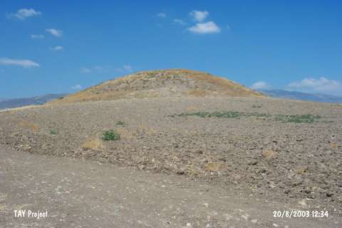 |
|
Type:
|
Mound |
|
Altitude:
|
725 m |
|
Region:
|
Black Sea |
|
Province:
|
Amasya |
|
District:
|
Merzifon |
|
Village:
|
Alicik |
|
Investigation Method:
|
Survey |
|
Period:
|
EBA III |
|
|
|
 |
|
| It lies 500 m south of the Alicik motorway; 4 km southwest of Merzifon; northwest of Amasya Province. It is a small mound surrounded by a fertile land. It was discovered in 1998 by a team under M. Özsait. It measures 10 m in height and 100 m in diameter. Except Aliaga Pinari; the mound is also known as Höyük; Höyük Pinari; Alicik Höyük or Kus Tepesi. It has been severely damaged by the treasure hunters. M. Özsait reports that sherds dating from the Late Chalcolithic Age; the EBA; the Colonial and Hittite Periods were collected from the surface. |
| Location: |
| Geography and Environment: |
| History: |
| Research and Excavation: |
| Stratigraphy: |
| Small Finds: |
| Remains: |
| Interpretation and Dating: |