|
©The Archaeological Settlements of Turkey - TAY Project
|
|
|
|
|
|
Aliaga Pinari |
|
|
For site maps and drawings please click on the picture...  |
For photographs please click on the photo... 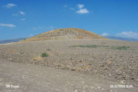 |
|
Type:
|
Mound |
|
Altitude:
|
725 m |
|
Region:
|
Black Sea |
|
Province:
|
Amasya |
|
District:
|
Merzifon |
|
Village:
|
Alicik |
|
Investigation Method:
|
Survey |
|
Period:
|
Early Iron Age Middle Iron Age |
|
|
|
 |
|
| It lies 500 m south of the Alicik motorway; 4 km southwest of Merzifon; northwest of Amasya Province. It is a small mound surrounded by a fertile land. It was discovered in 1987, and named after the site as Aliaga Pinari. It is in the middle of an arable field with a diameter of 100 m and height of 10 m. It has been heavily destroyed by illicit diggings. Sherds dating from the settlements in the Late Chalcolithic Age, EBA I-II-III, MBA, Colony and Old Hittite Periods, Early and Middle Iron Age, Hellenistic Period and Roman Period are observed on the surface. |
| Location: |
| Geography and Environment: |
| History: |
| Research and Excavation: |
| Stratigraphy: |
| Small Finds: |
| Remains: |
| Interpretation and Dating: |