| ©The Archaeological Settlements of Turkey - TAY Project | ||||||
|
|
||||||
Ilipinar |
||||||
|
|
||||||
| Ages | Maps | Photos | ||||
| Neolithic Chalcolithic EBA 14C |
 |
 |
||||
|
|
||||||
|
Type:
|
Mound | |||||
|
Altitude:
|
112 m | |||||
|
Diameter:
|
m- Direction: | |||||
|
|
||||||
|
Region:
|
Marmara | |||||
|
Province:
|
Bursa | |||||
|
District:
|
Orhangazi | |||||
|
Village:
|
Merkez | |||||
|
|
||||||
|
Destruction :
|
Highways, roads, bridges etc. | |||||
|
|
||||||
|
TAYEx:
|
Visited - 18/7/2000 | |||||
|
|
||||||
|
Registration State:
|
Registered For detailed registration information please refer to Turkish pages. | |||||
 |
||||||
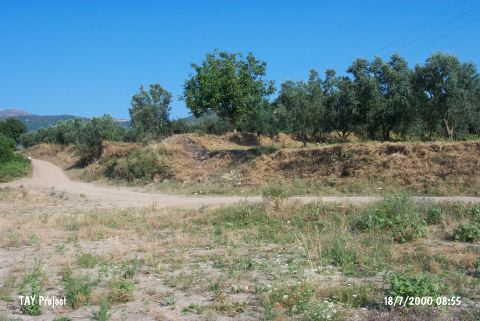
| Location: The site lies northeast of Bursa; approximately 1.5 - 2 km south of Orhangazi District; 4 km northeast of Gedelek Village. |
| Geography and Environment: The approximately 5 m high; broad mound; covering an area of 2-2.5 hectares; is located approximately 1.5 km away from the western shore of Iznik Lake. There is a strong fresh water source near the mound. |
| Destruction Details: A dirt road passes over the mound [TAYEx 18.7.2000]. |