|
©The Archaeological Settlements of Turkey - TAY Project
|
|
|
|
|
|
Ilipinar |
|
|
For site maps and drawings please click on the picture...  |
For photographs please click on the photo... 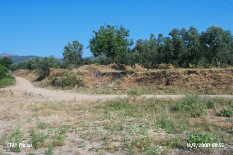 |
|
Type:
|
Mound |
|
Altitude:
|
112 m |
|
Region:
|
Marmara |
|
Province:
|
Bursa |
|
District:
|
Orhangazi |
|
Village:
|
Merkez |
|
Investigation Method:
|
Excavation |
|
Period:
|
Ceramic |
|
|
|
 |
|
| Location: The site lies northeast of Bursa; approximately 1.5 - 2 km south of Orhangazi District; 4 km northeast of Gedelek Village. |
| Geography and Environment: The approximately 5 m high; broad mound; covering an area of 2-2.5 hectares; is located approximately 1.5 km away from the western shore of Iznik Lake. There is a strong fresh water source near the mound. |
| History: |
| Research and Excavation: The site was researched for the first time by I. Kökten in 1948; by J. Mellaart in 1960; by Cullberg in 1964 and by D.H. French in 1965. Excavations between 1987 and 1995 have been conducted under the leadership of J. Roodenberg of the Istanbul Dutch Archaeology Institute. Approximately 1200 square meters were excavated. The excavations mainly took part in the central; eastern and southwestern parts of the mound. The profile exposed by the highway has been cleaned to help in understanding the stratigraphy of the site. It takes place in the registered archaeological sites list prepared by Ministry of Culture and Tourism. |
| Stratigraphy: From the top of the mound to virgin soil; the excavations have discovered a total of 10 layers. Layer I: The entire mound was used as a cemetery at the beginning of the seventh century and the end of the sixth century AD. The graves belonged to the Byzantine settlers in Orhangazi. Approximately 200 graves have been excavated so far. Layer II: This layer yielded stone walls which date to the Early Roman Period. In terms of construction technique; these walls resemble the stone walls near the water source. The pottery from this period has been assigned to the first and second centuries AD. Layer III: This layer; assigned to the end of the Bronze Age; is the layer where silos and trash pits with Inegöl Gray Ware were found. The architecture in this phase which must have existed during this period was probably destroyed by the Byzantine cemetery. Some bronze weapons dating to this period were found in the central part of the mound. Layer IV: This is an old cemetery layer. Some of the 40 graves have yielded grave-goods such as vessels and bronze objects. The bodies are in flexed position. Some of the black burnished ware has been decorated with filled-in excised decoration. These graves have been assigned to the Late Chalcolithic and are dated to the end of the fourth millennium B.C. (3;100-2;900 BC). Layer V: The ceramic finds from this layer; where large trash pits were found; have close affinity with Balkan Karanovo III and Early Vinca wares as well as with Ilipinar Layer VI. ware. This layer is dated to the second half of the fifth millennium BC. Layer VI: This layer; where burnt mud brick architecture was found; is dated to the fifth millennium BC and is assigned to the Early Chalcolithic Period. Layer VII: This layer; dated to the first half of the fifth millennium BC; is an Early Chalcolithic mudbrick architectural phase. Layer VIII-IX: These layers yielded pisé hut-like structures supported by wooden construction elements. They have been assigned to the transitional phase at the end of the Neolithic and the beginning of the Early Chalcolithic Periods. The finds from this layer; which date to the beginning of the fifth millennium BC; resemble those from Fikirtepe and the Balkans. Layer X: This is the Late Neolithic Phase; dated to the end of the sixth millennium BC where Hacilar and Fikirtepe horizon styles can be found. |
| Small Finds: Architecture: Layer X; assigned to the Late Neolithic Period by the excavation director; was mostly directly overlying virgin soil. From the cross-sectional profile the architecture in this phase appears to be comprised of wattle and daub-like structures held up by wooden support beams and finished with clay mortar over woven branches and reed bundles. However; the level believed to be contemporaneous with Layer X exposed in sounding "S 9" in the southwestern part of the mound was instead a layer of clayey soil. The structures built in Layer X were destroyed by fire. This is clear because of the well preserved house remains beneath a 40 cm thick ashy layer. This ashy level can be found both in the cross-sectional profile and in sounding "S 9". The house; which is 5x6 m in size; was constructed with 25 cm thick pisé walls. The pisé walls were constructed over wooden support beams [Roodenberg 1993:253; fig 3]. The 80 cm wide opening along the southern wall of this structure; which has been preserved to the height of 60 cm; must have been the main doorway to enter the house. Almost centered in the room is a clay hearth nearly oval in shape. In the northern corner of the house is a roughly made clay storage cupboard and a grinding stone. The western side of the room was equipped with a podium [Roodenberg 1993:fig 3]. The floor of the house has been plastered with clay (which has also burned). The intra-mural finds include an obsidian core; stone beads and figurine type small finds. The structure; in terms of construction technique; shows close affinity with the earliest Bulgarian Neolithic sites. Pottery: The ceramic finds from Layer X include hand-made; well fired; mineral; sand and vegetable tempered; burnished ware which ranges from orangish-light brown to gray in surface color. The plant tempering added to the clay gives the ware a Chaff Tempered Surface [Roodenberg 1989a:67-68]. The vessels in terms of shape are globular and mostly have slightly protruding lips. Some have horizontally placed and pierced lugs. The vessel bases are usually flat. Flaring vessels are rare. Chipped Stone: Although there are few obsidian tools; flint is the most common raw material in chipped stone tool production. The dominant industry is a blade based one. Bone/Antler: Because the bone tools at Ilipinar Layers X-VI have been reported together; it is difficult to be specific about Late Neolithic Layer X. Fauna: Even in the earlier levels at Ilipinar; it has been determined that the inhabitants domesticated sheep; goat; pig and cattle. |
| Remains: |
| Interpretation and Dating: Layer X at Ilipinar shows similarities with Fikirtepe/Pendik and Hacilar in Anatolia. An uncalibrated 14C date from this layer dates to 7;100-6;900 BP. The calibrated date is 5;900-5;700 BC [Roodenberg 1993:259]. |