|
|
||||
|
|
||||
|
Civelek Magarasi |
||||
|
For cave maps and drawings please click on the picture... |
For photographs please click on the photo... |
|||
|
 |
|||
|
Type: |
Cave | |||
|
Altitude: |
1230 m | |||
|
Depth: |
m | |||
|
Length: |
m | |||
|
Region: |
Central Anatolia | |||
|
Province: |
Nevsehir | |||
|
District: |
Gülsehir | |||
|
Village: |
Civelek | |||
|
|
||||
 |
||||
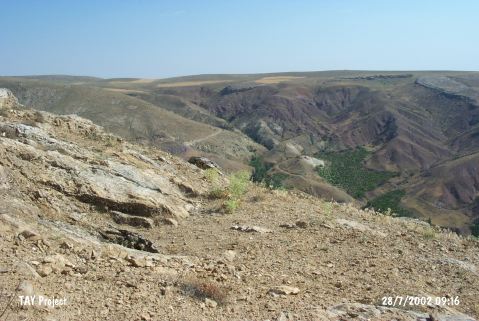
| Location: The site lies north of Nevsehir; 2.2 km north of Civelek Village; 4.8 km north-northeast of Gülsehir; at the southern ridges of Hirka Mountain; 7 km from Gülsehir District; at the northern bank of Halys. |
| Structural Properties and formation : It was reached through a passage; probably a chimney; of a 14 m long steep gallery in 1993. The main living area is 22x11 m. The floor is covered with calcite crystal rocks and debris falling from the roof. There are pouch-like small galleries. As it was not possible to reach some of these galleries due to big blocking rocks; the main entrance couldn't exactly have been figured out. |
| Research History: It was discovered in the winter of 1974 when some hunters noticed the water vapor coming out from a small hole; which was then enlarged by dynamite to have an opening one can pass through easily. Entering the cave through this tunnel; all pots and some stone items found were collected and delivered to the Nevsehir Museum; which was followed by a joint survey carried out by the Nevsehir Museum and the National Institute of Natural Speleology of Italy in 1993. It was like a small sounding and all potsherds among the big rocky blocks inside the cave were carefully collected. |
| Findings: All the potsherds collected from the cave have been examined in detail by a team under the leadership of A. Schachner; and presented to the scientific world. |