| ©The Archaeological Settlements of Turkey - TAY Project | ||||||
|
|
||||||
Gire Korriye |
||||||
|
|
||||||
| Ages | Maps | Photos | ||||
| EBA |
 |
 |
||||
|
|
||||||
|
Type:
|
Mound | |||||
|
Altitude:
|
410 m | |||||
|
Diameter:
|
m- Direction: | |||||
|
|
||||||
|
Region:
|
Southeastern Anatolia | |||||
|
Province:
|
Mardin | |||||
|
District:
|
Kiziltepe | |||||
|
Village:
|
Büyüktepe | |||||
|
|
||||||
|
Destruction :
|
Contemporary Settlements - Natural causes | |||||
|
|
||||||
|
TAYEx:
|
Visited - 20/9/2001 | |||||
|
|
||||||
|
Registration State:
|
For detailed registration information please refer to Turkish pages. | |||||
 |
||||||
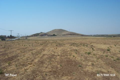
| Location: |
| Geography and Environment: |
| Destruction Details: The site of Gire Korriye is destructed by contemporary settlement and natural causes. There are sunken areas occurred by of erosion and gutters made by rain. There are houses on northeast and east slopes of the mound ; there is also a place where a holy man is buried on eastern skirt. It is recorded that the settlement which the whole north portion cut was being destructed by removing soil by the time the documentation work was being done [TAYEx 20.9.2001]. |