| ©The Archaeological Settlements of Turkey - TAY Project | ||||||
|
|
||||||
Girbunas |
||||||
|
|
||||||
| Ages | Maps | Photos | ||||
| EBA |
 |
 |
||||
|
|
||||||
|
Type:
|
Mound | |||||
|
Altitude:
|
370 m | |||||
|
Diameter:
|
m- Direction: | |||||
|
|
||||||
|
Region:
|
Southeastern Anatolia | |||||
|
Province:
|
Mardin | |||||
|
District:
|
Kiziltepe | |||||
|
Village:
|
Büyükdere | |||||
|
|
||||||
|
Destruction :
|
Natural causes - Agriculture - Contemporary Settlements | |||||
|
|
||||||
|
TAYEx:
|
Visited - 20/9/2001 | |||||
|
|
||||||
|
Registration State:
|
For detailed registration information please refer to Turkish pages. | |||||
 |
||||||
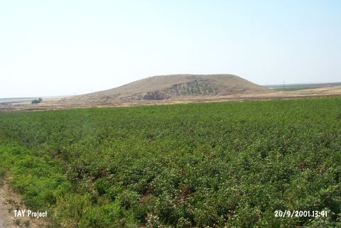
| Location: |
| Geography and Environment: |
| Destruction Details: The site of Girbunas is destructed by contemporary settlement and agricultural activities. Soil taken from eastern skirts of the mound and at this portion landslide has occurred. On the southwest section of the hill the contemporary cemetery takes place. Agricultural activities are being done on the extension of the mound south and west directions [TAYEx 20.9.2001]. |