|
©The Archaeological Settlements of Turkey - TAY Project
|
|
|
|
|
|
Girbunas |
|
|
For site maps and drawings please click on the picture...  |
For photographs please click on the photo... 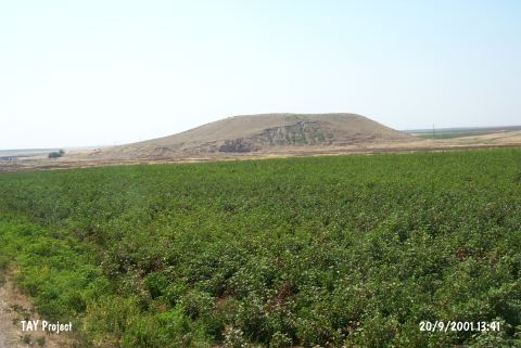 |
|
Type:
|
Mound |
|
Altitude:
|
370 m |
|
Region:
|
Southeastern Anatolia |
|
Province:
|
Mardin |
|
District:
|
Kiziltepe |
|
Village:
|
Büyükdere |
|
Investigation Method:
|
Survey |
|
Period:
|
EBA III |
|
|
|
 |
|
| It is located on the western bank of the Zergan Stream; 10.9 km south of village of Akyüz and about 22 km south of Kiziltepe; south-southwest of Mardin Province. It lies on common fields of Büyükdere (Bunase) and Demirkapı (Merso). It was discovered by the Girnavaz team in 1991-1992. The surface material was analyzed by E. Ay. Samples of the metallic ware were collected from the surface [Ay 1993:pl.II/9-10][Ay 1995:18; map 27 findspot No.10]. It was dated to the Early Dynasty II-III. |
| Location: |
| Geography and Environment: |
| History: |
| Research and Excavation: |
| Stratigraphy: |
| Small Finds: |
| Remains: |
| Interpretation and Dating: |