| ©The Archaeological Settlements of Turkey - TAY Project | ||||||
|
|
||||||
Fatmali Kalecik |
||||||
|
|
||||||
| Ages | Maps | Photos | ||||
| Chalcolithic 14C |
 |
 |
||||
|
|
||||||
|
Type:
|
Mound | |||||
|
Altitude:
|
840 m | |||||
|
Diameter:
|
m- Direction: | |||||
|
|
||||||
|
Region:
|
Eastern Anatolia | |||||
|
Province:
|
Elazig | |||||
|
District:
|
Keban | |||||
|
Village:
|
Fatmali | |||||
|
|
||||||
|
Destruction :
|
Dams | |||||
|
|
||||||
|
TAYEx:
|
Not visited - 20/7/2003 | |||||
|
|
||||||
|
Registration State:
|
For detailed registration information please refer to Turkish pages. | |||||
 |
||||||
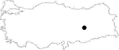
| Location: The site lied approximately 32 km northwest of Elazig; southeast of Agin District; and 4200 m south-southeast of Fatmali Village before it was inundated by Keban Dam. The location code of the site is N 52 / 3. |
| Geography and Environment: The mound was located on a narrow valley surrounded by hills covered with oak forests. The northern part of the valley opens to Murat Stream. A spring from the bottom of the mound used to form a little creek; and join with Murat Stream; which lies a few km north. The mound is reported to be flat and small; 2 m high above the level of the plain; and 60 m in diameter. |
| Destruction Details: The mound is flooded by dam reservoir [TAYEx 20.7.2003]. |