|
©The Archaeological Settlements of Turkey - TAY Project
|
|
|
|
|
|
Fatmali Kalecik |
|
|
For site maps and drawings please click on the picture... 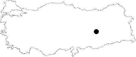 |
For photographs please click on the photo...  |
|
Type:
|
Mound |
|
Altitude:
|
840 m |
|
Region:
|
Eastern Anatolia |
|
Province:
|
Elazig |
|
District:
|
Keban |
|
Village:
|
Fatmali |
|
Investigation Method:
|
Excavation |
|
Period:
|
Early Late |
|
|
|
 |
|
| Location: The site lied approximately 32 km northwest of Elazig; southeast of Agin District; and 4200 m south-southeast of Fatmali Village before it was inundated by Keban Dam. The location code of the site is N 52 / 3. |
| Geography and Environment: The mound was located on a narrow valley surrounded by hills covered with oak forests. The northern part of the valley opens to Murat Stream. A spring from the bottom of the mound used to form a little creek; and join with Murat Stream; which lies a few km north. The mound is reported to be flat and small; 2 m high above the level of the plain; and 60 m in diameter. |
| History: |
| Research and Excavation: The site was discovered during the survey; with the aim of finding sites that were going to be inundated by Keban Dam; conducted by R. Whallon and S. Kantman. A systematic surface collection was made; and a small trial trench was opened in 1968 to check whether the results of the surface collection complies with the results of the excavation. A ditch-shaped trench; 10 m long and 1 m wide; approximately in the north-south direction; was excavated. In addition; a 2x2 m area was excavated north of the trench. |
| Stratigraphy: According to the results of the excavations; the cultural deposit of the northern part of the mound is 3.9 m thick; while the southern part is 2.8 m thick. The excavated area consists of the first level (3.9 m thick); measuring 40 m in diameter from the profile of the trench; and a second level above. The village is observed to be enlarged at the second settlement. |
| Small Finds: Architecture: Architectural remains were not very well revealed because of the smallness of the trenches. Building remains belonging to the first settlement could not be found. However; very small units of buildings with stone foundation and mud-brick walls; from later periods; were revealed. A structure that has three building phases was found. Pottery: Lower/First Settlement Level: Sherds of hand-made; dark brown; gray; burnished ware were recovered. Their paste is observed to be tempered with small rock particles. In addition; a few whole vessels were found. There are forms such as shallow bowls; pithoi with flaring rims; and sieves. Upper/Second Settlement Level: Sherds of hand-made; red faced; burnished ware and straw-tempered; crème; red; light brown faced ware were observed. Chipped Stone: Flintstone was observed to be used 6 times more than obsidian at the lower level. Core; knives; side scraper pieces and abundant waste pieces are existent. Obsidian is observed to be common in the upper level. Tools and weapons such as side scrapers; end scrapers; dagger; and arrowhead are not abundant. Ground Stone: Grinding stone and its pieces were recovered from the lower level. Hammer stones were found at the upper level. In addition; the industry is similar to the lower level. Metal: A copper piece; and many slag pieces were recovered. Fauna: Bones of sheep; goat; cow; and dog were found at the lowest level. All of them are observed to be domesticated. Mostly; sheep and goat were consumed. Pig; badger; fox; and wild rabbit bones; plus the animals from the lower level; were recovered from the upper level. |
| Remains: |
| Interpretation and Dating: Fatmali-Kalecik; also known as Adsiztepe; was excavated to test the results of a surface collection. The results of the collection are observed to be correct. |