| ©The Archaeological Settlements of Turkey - TAY Project | ||||||
|
|
||||||
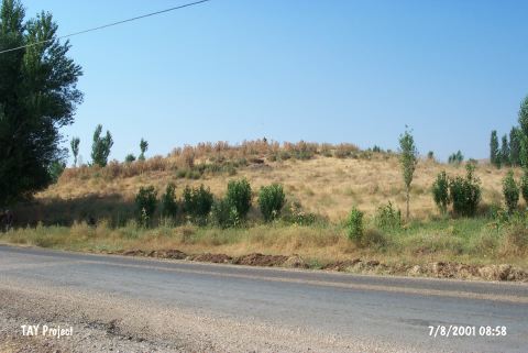
Emirilyas |
||||||
|
|
||||||
| Ages | Maps | Photos | ||||
| EBA |
 |
 |
||||
|
|
||||||
|
Type:
|
Mound | |||||
|
Altitude:
|
1280 m | |||||
|
Diameter:
|
m- Direction: | |||||
|
|
||||||
|
Region:
|
Eastern Anatolia | |||||
|
Province:
|
Kahramanmaras | |||||
|
District:
|
Afsin | |||||
|
Village:
|
Emirilyas | |||||
|
|
||||||
|
Destruction :
|
Illicit Digging - Agriculture | |||||
|
|
||||||
|
TAYEx:
|
Visited - 7/8/2001 | |||||
|
|
||||||
|
Registration State:
|
For detailed registration information please refer to Turkish pages. | |||||
 |
||||||
| Location: |
| Geography and Environment: |
| Destruction Details: The northwest skirt of the mound is being cultivated and northeast is terraced. There are pits of illicit diggings on north-northeast section and electricity poles on east slope [TAYEx 7.8.2001]. |