| ©The Archaeological Settlements of Turkey - TAY Project | ||||||
|
|
||||||
Elvanli / Tömükkale |
||||||
|
|
||||||
| Ages | Maps | Photos | ||||
| Neolithic IA |
 |
 |
||||
|
|
||||||
|
Type:
|
Mound | |||||
|
Altitude:
|
160 m | |||||
|
Diameter:
|
m- Direction: | |||||
|
|
||||||
|
Region:
|
Mediterranean | |||||
|
Province:
|
Mersin | |||||
|
District:
|
Erdemli | |||||
|
Village:
|
Tömük | |||||
|
|
||||||
|
Destruction :
|
Agriculture | |||||
|
|
||||||
|
TAYEx:
|
Visited - 13/7/2001 | |||||
|
|
||||||
|
Registration State:
|
Registered For detailed registration information please refer to Turkish pages. | |||||
 |
||||||
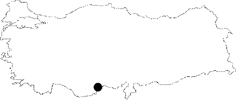
| Location: This site lies southwest of the city of Mersin; west of the town of Tömük (Elvanli); and south of the Silifke-Mersin highway. |
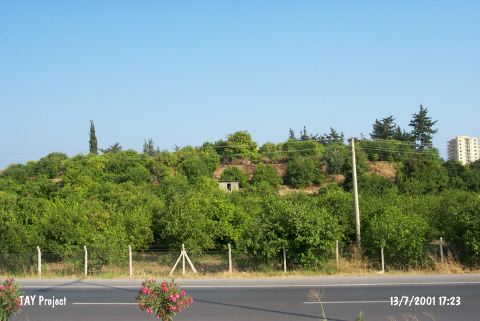
| Geography and Environment: This mound; which lies in the Elvanli Plain; is 10 m high and has a 150 m diameter. There are no nearby water sources. The remains of fortification on the northeastern side of the mound suggest that the mound was used as a fortress in the later periods. These ruins account for the name Tömükkale; another name for this mound; which literally means "Fort Tömük". Mellaart; on the other hand; refers to this site as Elvanli Höyük; after the plain it lies in. |
| Destruction Details: The mound has been completely afforested and a house locates on its western skirt [TAYEx 13.7.2001]. |