|
©The Archaeological Settlements of Turkey - TAY Project
|
|
|
|
|
|
Elvanli / Tömükkale |
|
|
For site maps and drawings please click on the picture... 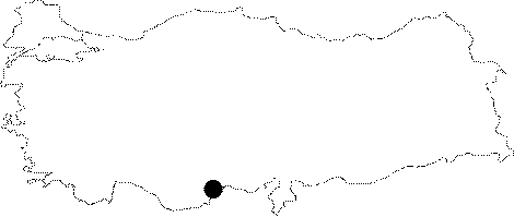 |
For photographs please click on the photo... 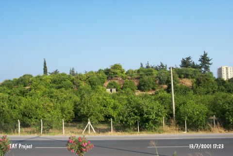 |
|
Type:
|
Mound |
|
Altitude:
|
160 m |
|
Region:
|
Mediterranean |
|
Province:
|
Mersin |
|
District:
|
Erdemli |
|
Village:
|
Tömük |
|
Investigation Method:
|
Survey |
|
Period:
|
|
|
|
|
 |
|
| Located in the Elvanli (also called Tömük) Plain, it is 10 m in height, and 150 m in diameter. No spring source is found in the environs. Remains of a fortification wall on the northeastern section suggest that the hill was used as a fortress during the later periods, and that is why it is referred as Tömükkale (Fort of Tömük). The site was called Elvanli Höyük by Mellaart. It was surveyed in 1951 by J. Mellaart, and in 1963 by D.H. French. It had been inhabited from the Neolithic-Early Chalcolithic Age to the Islamic Period. It takes place in the registered archaeological sites list prepared by Ministry of Culture and Tourism. |
| Location: This site lies southwest of the city of Mersin; west of the town of Tömük (Elvanli); and south of the Silifke-Mersin highway. |
| Geography and Environment: This mound; which lies in the Elvanli Plain; is 10 m high and has a 150 m diameter. There are no nearby water sources. The remains of fortification on the northeastern side of the mound suggest that the mound was used as a fortress in the later periods. These ruins account for the name Tömükkale; another name for this mound; which literally means "Fort Tömük". Mellaart; on the other hand; refers to this site as Elvanli Höyük; after the plain it lies in. |
| History: |
| Research and Excavation: |
| Stratigraphy: |
| Small Finds: |
| Remains: |
| Interpretation and Dating: |