| ©The Archaeological Settlements of Turkey - TAY Project | ||||||
|
|
||||||
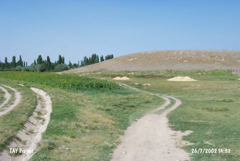
Egriköy |
||||||
|
|
||||||
| Ages | Maps | Photos | ||||
| EBA IA |
 |
 |
||||
|
|
||||||
|
Type:
|
Mound | |||||
|
Altitude:
|
1125 m | |||||
|
Diameter:
|
240 m- Direction: SSE-NNW | |||||
|
|
||||||
|
Region:
|
Central Anatolia | |||||
|
Province:
|
Kayseri | |||||
|
District:
|
Yesilhisar | |||||
|
Village:
|
Yesilova | |||||
|
|
||||||
|
Destruction :
|
Illicit Digging - Contemporary Settlements - Highways, roads, bridges etc. | |||||
|
|
||||||
|
TAYEx:
|
Visited - 26/7/2002 | |||||
|
|
||||||
|
Registration State:
|
For detailed registration information please refer to Turkish pages. | |||||
 |
||||||
| Location: |
| Geography and Environment: |
| Destruction Details: The mound has been damaged due to illicit diggings; contemporary settlement and a road. There are lots of pits on top hill and a water reservoir on northeast skirt. The dirt road coming from north cuts the skirt [TAYEx 26.7.2002]. |