| ©The Archaeological Settlements of Turkey - TAY Project | ||||||
|
|
||||||
Dündartepe |
||||||
|
|
||||||
| Ages | Maps | Photos | ||||
| EBA |
 |
 |
||||
|
|
||||||
|
Type:
|
Mound | |||||
|
Altitude:
|
1840 m | |||||
|
Diameter:
|
150 m- Direction: WNW-ESE | |||||
|
|
||||||
|
Region:
|
Eastern Anatolia | |||||
|
Province:
|
Kars | |||||
|
District:
|
Merkez | |||||
|
Village:
|
Azat | |||||
|
|
||||||
|
Destruction :
|
Illicit Digging - Contemporary Settlements | |||||
|
|
||||||
|
TAYEx:
|
Visited - 1/7/2003 | |||||
|
|
||||||
|
Registration State:
|
Registered For detailed registration information please refer to Turkish pages. | |||||
 |
||||||
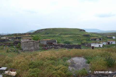
| Location: It lies in the village of Azat; east of the Kars-Kagizman motorway; 8-9 km south of the Kars Province. The name Dündartepe was given by K. Kökten. |
| Geography and Environment: It is located on the northern bank of the Azat Stream. It is seen as a small mound from the pictures. No information is provided about its size. |
| Destruction Details: The site has been damaged due to illicit diggings and contemporary settlements. A large amount of soil was removed from its northeastern slope and houses were built in this area [TAYEx 1.7.2003]. |