| ©The Archaeological Settlements of Turkey - TAY Project | ||||||
|
|
||||||
Dere Mahallesi Yerlesimi ve Mezarligi |
||||||
|
|
||||||
| Ages | Maps | Photos | ||||
| Chalcolithic EBA |
 |
 |
||||
|
|
||||||
|
Type:
|
Flat Settlement and Cemetery | |||||
|
Altitude:
|
350 m | |||||
|
Diameter:
|
185 m- Direction: SW-NE | |||||
|
|
||||||
|
Region:
|
Black Sea | |||||
|
Province:
|
Tokat | |||||
|
District:
|
Erbaa | |||||
|
Village:
|
Merkez | |||||
|
|
||||||
|
Destruction :
|
Agriculture - Contemporary Settlements - Highways, roads, bridges etc. - Attention | |||||
|
|
||||||
|
TAYEx:
|
Visited - 28/8/2003 | |||||
|
|
||||||
|
Registration State:
|
Registered For detailed registration information please refer to Turkish pages. | |||||
 |
||||||
| Location: The mound lies north of Tokat; west-southwest of Erbaa. |
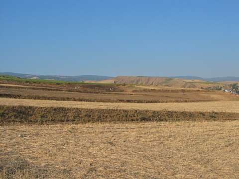
| Geography and Environment: It was cited as "Horoztepe" in archaeological publications. The site was used as a graveyard of Dere quarter after the earthquake. Imbat stream passes near the site that sees Yesilirmak. |
| Destruction Details: The settlement has been severely damaged due to cultivation [TAYEx 28.8.2003]. |