| ©The Archaeological Settlements of Turkey - TAY Project | ||||||
|
|
||||||
Erythrai |
||||||
|
|
||||||
| Ages | Maps | Photos | ||||
| EBA IA |
 |
 |
||||
|
|
||||||
|
Type:
|
City | |||||
|
Altitude:
|
m | |||||
|
Diameter:
|
m- Direction: | |||||
|
|
||||||
|
Region:
|
Aegean | |||||
|
Province:
|
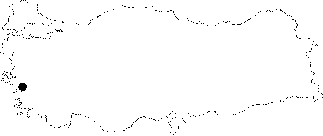
Izmir | |||||
|
District:
|
Çesme | |||||
|
Village:
|
Ildir | |||||
|
|
||||||
|
|
||||||
|
|
||||||
|
TAYEx:
|
- | |||||
|
|
||||||
|
Registration State:
|
Registered For detailed registration information please refer to Turkish pages. | |||||
 |
||||||
| Location: It is situated in the Ildiri Village of the Alaçati Subdistrict, 20 km northeast of the Çesme District in Izmir [Sevin 2001a:255]. |
| Geography and Environment: It was founded on a shore where part of the coast bore the name of Leopodon within a gulf delimited by Cape Coryne to the northwest (Teke/Çolak), Cape Mesate (Top) to the southeast. It is situated facing four small islands, called Hippi during the ancient period, currently known as Karaada, Tavsan Island, Yassiada and Orak Island [Sevin 2001a:90]. |
| Destruction Details: |