|
©The Archaeological Settlements of Turkey - TAY Project
|
|
|
|
|
|
Erythrai |
|
|
For site maps and drawings please click on the picture... 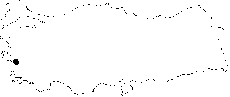 |
For photographs please click on the photo...  |
|
Type:
|
City |
|
Altitude:
|
m |
|
Region:
|
Aegean |
|
Province:
|
Izmir |
|
District:
|
Çesme |
|
Village:
|
Ildir |
|
Investigation Method:
|
Excavation |
|
Period:
|
|
|
|
|
 |
|
| It is located in Ildir Village in Çesme District of Izmir Province. In 2013, remains belonging to EBA were exposed. In Trench ERT13CT-014, EBA potsherds were found. At a depth of 30 cm from the surface, remnants of stone were exposed. The rest of the trench consists of bedrock. In Trench ERT12/13 CT015, a great number of EBA wares were recovered in 2012. In the east of the area, EBA Level was reached. This level distinguishes with its red colored, solid soil. The remnants of stone showing no particular plan were removed. In this section, a black burnished tankard sherd, spouted pitcher and a bright burnished lug belonging to EBA II were found. In the same area, a pit containing Late Period material was discovered. Below this pit, a wall extending in the east-west direction was exposed. This wall is dated to EBA [http://www.ttk.gov.tr/templates/resimler/File/Kazilar/2013/22-2013_Ryhrai.pdf, 2.7.2016, 17:53]. |
| Location: It is situated in the Ildiri Village of the Alaçati Subdistrict, 20 km northeast of the Çesme District in Izmir [Sevin 2001a:255]. |
| Geography and Environment: It was founded on a shore where part of the coast bore the name of Leopodon within a gulf delimited by Cape Coryne to the northwest (Teke/Çolak), Cape Mesate (Top) to the southeast. It is situated facing four small islands, called Hippi during the ancient period, currently known as Karaada, Tavsan Island, Yassiada and Orak Island [Sevin 2001a:90]. |
| History: |
| Research and Excavation: |
| Stratigraphy: |
| Small Finds: |
| Remains: |
| Interpretation and Dating: |