| ©The Archaeological Settlements of Turkey - TAY Project | ||||||
|
|
||||||
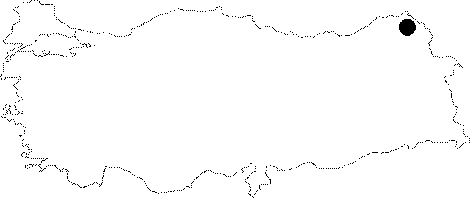
Akçakale |
||||||
|
|
||||||
| Ages | Maps | Photos | ||||
| IA |
 |
 |
||||
|
|
||||||
|
Type:
|
Fortress | |||||
|
Altitude:
|
m | |||||
|
Diameter:
|
m- Direction: | |||||
|
|
||||||
|
Region:
|
Eastern Anatolia | |||||
|
Province:
|
Ardahan | |||||
|
District:
|
Çildir | |||||
|
Village:
|
Akçakale | |||||
|
|
||||||
|
|
||||||
|
|
||||||
|
TAYEx:
|
- | |||||
|
|
||||||
|
Registration State:
|
For detailed registration information please refer to Turkish pages. | |||||
 |
||||||
| Location: It lies on an island 500 m west of the Akçakale Village, 27 km southeast of the Çildir District in Ardahan. |
| Geography and Environment: At present, the area between the island and the village has been filled up, and the island is easily accessible by road. Recently it has been enlarged enough to allow the passage of motor vehicles. |
| Destruction Details: |