|
©The Archaeological Settlements of Turkey - TAY Project
|
|
|
|
|
|
Akçakale |
|
|
For site maps and drawings please click on the picture... 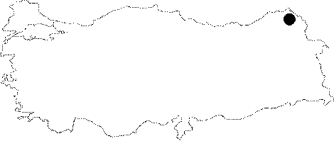 |
For photographs please click on the photo...  |
|
Type:
|
Fortress |
|
Altitude:
|
m |
|
Region:
|
Eastern Anatolia |
|
Province:
|
Ardahan |
|
District:
|
Çildir |
|
Village:
|
Akçakale |
|
Investigation Method:
|
Excavation |
|
Period:
|
Early Iron Age Middle Iron Age |
|
|
|
 |
|
| Location: It lies on an island 500 m west of the Akçakale Village, 27 km southeast of the Çildir District in Ardahan. |
| Geography and Environment: At present, the area between the island and the village has been filled up, and the island is easily accessible by road. Recently it has been enlarged enough to allow the passage of motor vehicles. |
| History: |
| Research and Excavation: The island was first surveyed by I.K. Kökten. Kökten indicated that the dolmen on the skirts of the tumulus have a Neolithic masonry, and he uncovered very rough, matt-black colored sherds. He also mentioned the presence of menhirs, portal tombs and remains of a mortared wall, a very prominent fortress and a small tower while indicating that he found a limestone tool during the sounding he conducted [Kökten 1944:671]. In the meantime, K. Köroglu compared the graves in Akçakale to the ones in Causacia dating to the Middle Bronze Age during this research in 1995 [Köroglu 1997; Köroglu 2000:2]. Furthermore, H. Gündogdu, who made an excursion in the region, provided information about the fortress, tower and chapel in Akçakale. In 2001, A. Ceylan conducted a survey and prepared a report informing the presence of many architectural remains. An excavation was conducted in 2004 and 2005 under the direction of A. Ceylan by the Museum Directorate of Kars in order to determine the period of the structures included in the report and carry out a cleaning work. |
| Stratigraphy: |
| Small Finds: Architecture: In the excavation area 1 so called "Tasli Dam" (Stoned Stable) by Kökten, the interior and exterior parts were thoroughly cleaned, and restored. Covering an area of 19.8 squaremeters, all of the architectural elements of the Tasli Dam are of stone. It is 2.2 m high, and inside there is a fresh water source topped with a large flagstone. Also, it was found out that the stones used as beams and the stones at the entrance were cut using a technique called "wolf teeth". A stone door belonging to the structure was found, and its related doorjambs were identified. The ground was covered with a specific homogenous red-colored soil layer of 2 cm thick. The excavation area 2 lies 4.7 m to the southeast of the Taşli Dam and to the south of the island. A somewhat thick wall in the middle divides the area into two. The excavation area 2 is an area previously exposed by illicit diggings. Down at 2.1 m, a 70 cm wide entrance extending to the east was unearthed. Obviously having no features of a gate entrance, it was found out that it was one of the pathways leading to the architectural ruins innerside. The excavation area 3 was formed as a result of depression, and it lies 11.4 m to the southwest of the Tasli Dam. As in the others, this area was also filled with garbage dumps. After clearing this depression area, which measures 2.1 m in diameter, pathways leading to two directions were found after the rubbles were removed. The first one was called the West Pathway. Advancing aproximately for 1 m towards the west, and then beding to the northwest, it gets blocked by debris 9 m further. With a diameter of 1.2 m, this pathway is 1.85 m deep from the surface. The second pathway is called the East Pathway. It advances for 1.5 m to the east, and then bends toward the southeast. Both pathways have been filled up by the lake water. The excavation area 4, which lies 16 m south of the Tasli Dam has been also exposed due to illicit diggings. The rubbles uncovered here with an unidentified location were gathered on an empty ground. This excavation area also yielded an entrance as it was in the area 2. The entrance has a diameter of 90 cm, being completely filled with water, and it was found out that it stretches further northwards. |
| Remains: |
| Interpretation and Dating: It seems that the Akçakale Island had a strategic location for Anatolia and Caucaisa. It is believed that new systematic excavations to be conducted in the island will bring light to the history of Anatolia as well as the history of Caucaisa. Discovery of structural remains, mostly observed in the Neolithic Age, indicates that it had been uninterruptedly inhabited from the Neolithic Age. The surveys conducted in the overall island yielded potsherds from the Iron Age as well as sherds from almost any of the historical periods. |