| ©The Archaeological Settlements of Turkey - TAY Project | ||||||
|
|
||||||
Çola Avika |
||||||
|
|
||||||
| Ages | Maps | Photos | ||||
| Chalcolithic |
 |
 |
||||
|
|
||||||
|
Type:
|
Mound | |||||
|
Altitude:
|
700 m | |||||
|
Diameter:
|
m- Direction: | |||||
|
|
||||||
|
Region:
|
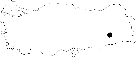
Southeastern Anatolia | |||||
|
Province:
|
Batman | |||||
|
District:
|
Kozluk | |||||
|
Village:
|
||||||
|
|
||||||
|
|
||||||
|
|
||||||
|
TAYEx:
|
Not visited - 16/9/2001 | |||||
|
|
||||||
|
Registration State:
|
For detailed registration information please refer to Turkish pages. | |||||
 |
||||||
| Location: The site lies northeast of the city of Batman; west of Kozluk District; across Nevala Denik. |
| Geography and Environment: The broad and low mound is 1-2 m high; and measures 100 m in diameter; is located at the northern bank of Remdenka Stream. The site approximately covers an area of 0.75 hectares. |
| Destruction Details: |