| ©The Archaeological Settlements of Turkey - TAY Project | ||||||
|
|
||||||
Çiradere |
||||||
|
|
||||||
| Ages | Maps | Photos | ||||
| EBA |
 |
 |
||||
|
|
||||||
|
Type:
|
Mound | |||||
|
Altitude:
|
1250 m | |||||
|
Diameter:
|
m- Direction: | |||||
|
|
||||||
|
Region:
|
Black Sea | |||||
|
Province:
|
Çorum | |||||
|
District:
|
Alaca | |||||
|
Village:
|
Suludere | |||||
|
|
||||||
|
Destruction :
|
Illicit Digging | |||||
|
|
||||||
|
TAYEx:
|
Visited - 15/8/2003 | |||||
|
|
||||||
|
Registration State:
|
For detailed registration information please refer to Turkish pages. | |||||
 |
||||||
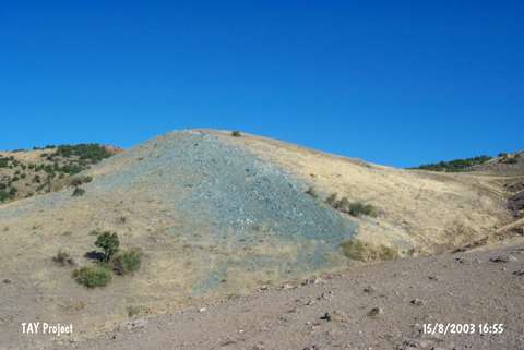
| Location: It lies east of the mosque in Suludere (Çiradere) Villge; 8.5 km northeast of Bogazkale District of Çorum Province. |
| Geography and Environment: It is a small settlement located on the southern bank of a small stream cleaving the rocks. |
| Destruction Details: The mound is being damaged due to illicit diggings [TAYEx 15.8.2003]. |