| ©The Archaeological Settlements of Turkey - TAY Project | ||||||
|
|
||||||
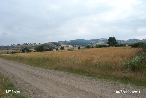
Çavustarla Mevkii |
||||||
|
|
||||||
| Ages | Maps | Photos | ||||
| Palaeolithic/Epipalaeolithic |
 |
 |
||||
|
|
||||||
|
Type:
|
Habitation Site / Workshop | |||||
|
Altitude:
|
150 m | |||||
|
Diameter:
|
m- Direction: | |||||
|
|
||||||
|
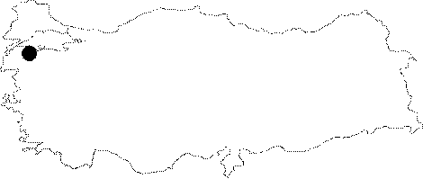
Region:
|
Marmara | |||||
|
Province:
|
Çanakkale | |||||
|
District:
|
Çan | |||||
|
Village:
|
Karli | |||||
|
|
||||||
|
Destruction :
|
Agriculture | |||||
|
|
||||||
|
TAYEx:
|
Visited - 30/6/2000 | |||||
|
|
||||||
|
Registration State:
|
For detailed registration information please refer to Turkish pages. | |||||
 |
||||||
| Location: The open-air habitation site lies southeast of the city of Çanakkale; along the terraces of the Çalça River; which are immediately off the road that runs between Çan and Karliköy. The terraces are located south of the village of Karliköy and about 7 km west of the town of Çan. The survey code of this site is H 4 / 7. |
| Geography and Environment: The Çan Region is much less mountainous than the Biga Region northeast of it. The Biga (Kocabas) Stream flows across the Çan Plain before it empties into the Marmara Sea. This stream can be torrid; especially in spring and late winter. |
| Destruction Details: The surface of the settlement is being used as a field [TAYEx 30.6.2000]. |