|
©The Archaeological Settlements of Turkey - TAY Project
|
|
|
|
|
|
Çavustarla Mevkii |
|
|
For site maps and drawings please click on the picture...  |
For photographs please click on the photo... 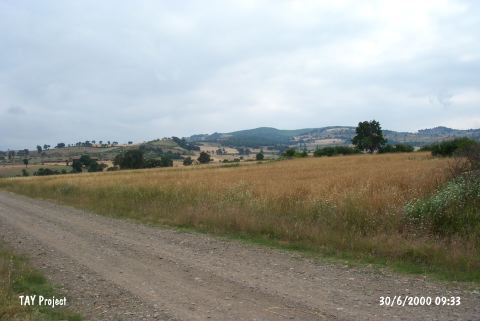 |
|
Type:
|
Habitation Site / Workshop |
|
Altitude:
|
150 m |
|
Region:
|
Marmara |
|
Province:
|
Çanakkale |
|
District:
|
Çan |
|
Village:
|
Karli |
|
Investigation Method:
|
Survey |
|
Period:
|
AP |
|
|
|
 |
|
| Location: The open-air habitation site lies southeast of the city of Çanakkale; along the terraces of the Çalça River; which are immediately off the road that runs between Çan and Karliköy. The terraces are located south of the village of Karliköy and about 7 km west of the town of Çan. The survey code of this site is H 4 / 7. |
| Geography and Environment: The Çan Region is much less mountainous than the Biga Region northeast of it. The Biga (Kocabas) Stream flows across the Çan Plain before it empties into the Marmara Sea. This stream can be torrid; especially in spring and late winter. |
| History: |
| Research and Excavation: The site was discovered by M. Özdogan during his 1989 survey of the Marmara Region |
| Stratigraphy: |
| Small Finds: Özdogan reports that he discovered finds he assigns to a transitional phase between the Lower and the Middle Palaeolithic [Özdogan 1991]; but further information has not been provided. |
| Remains: |
| Interpretation and Dating: |