| ©The Archaeological Settlements of Turkey - TAY Project | ||||||
|
|
||||||
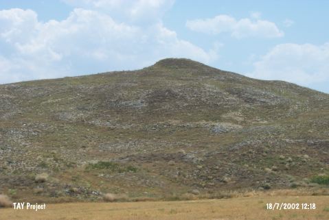
Çagil Tepe / Çeel Tepe |
||||||
|
|
||||||
| Ages | Maps | Photos | ||||
| EBA |
 |
 |
||||
|
|
||||||
|
Type:
|
Upland Settlement | |||||
|
Altitude:
|
625 m | |||||
|
Diameter:
|
45 m- Direction: NE-SE | |||||
|
|
||||||
|
Region:
|
Central Anatolia | |||||
|
Province:
|
Çorum | |||||
|
District:
|
Ugurludag | |||||
|
Village:
|
Üçdam | |||||
|
|
||||||
|
Destruction :
|
Illicit Digging | |||||
|
|
||||||
|
TAYEx:
|
Visited - 18/7/2002 | |||||
|
|
||||||
|
Registration State:
|
For detailed registration information please refer to Turkish pages. | |||||
 |
||||||
| Location: |
| Geography and Environment: |
| Destruction Details: The site is being destructed by illicit digging. There is a pit on top hill measuring 5x5x3 m and traces of wall can be seen in another pit on east slope [TAYEx 18.7.2002]. |