|
©The Archaeological Settlements of Turkey - TAY Project
|
|
|
|
|
|
Çagil Tepe / Çeel Tepe |
|
|
For site maps and drawings please click on the picture...  |
For photographs please click on the photo... 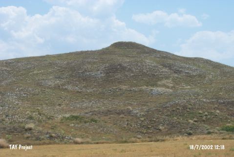 |
|
Type:
|
Upland Settlement |
|
Altitude:
|
625 m |
|
Region:
|
Central Anatolia |
|
Province:
|
Çorum |
|
District:
|
Ugurludag |
|
Village:
|
Üçdam |
|
Investigation Method:
|
Survey |
|
Period:
|
|
|
|
|
 |
|
| It stands on a natural elevation; east of the village road; 500 m south of Üçdam Village; near a valley opening to the river on the southern bank of the Kizilirmak River; west of Çorum Province. It is an oval shaped mound. It was discovered during the Survey of Çorum conducted under T. Sipahi and T. Yildirim in 1996. Only sherds dating from the third millennium BC were collected from the surface. The researchers also report that they recovered fragment of a bull figurine. |
| Location: |
| Geography and Environment: |
| History: |
| Research and Excavation: |
| Stratigraphy: |
| Small Finds: |
| Remains: |
| Interpretation and Dating: |