| ©The Archaeological Settlements of Turkey - TAY Project | ||||||
|
|
||||||
Cinis |
||||||
|
|
||||||
| Ages | Maps | Photos | ||||
| EBA |
 |
 |
||||
|
|
||||||
|
Type:
|
Mound | |||||
|
Altitude:
|
1780 m | |||||
|
Diameter:
|
m- Direction: | |||||
|
|
||||||
|
Region:
|
Eastern Anatolia | |||||
|
Province:
|
Erzurum | |||||
|
District:
|
Askale | |||||
|
Village:
|
Ortabahçe | |||||
|
|
||||||
|
Destruction :
|
Contemporary Settlements - Attention | |||||
|
|
||||||
|
TAYEx:
|
Visited - 27/6/2003 | |||||
|
|
||||||
|
Registration State:
|
Registered For detailed registration information please refer to Turkish pages. | |||||
 |
||||||
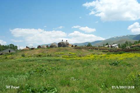
| Location: |
| Geography and Environment: |
| Destruction Details: The mound has been completely damaged and only a cylindrical elevation has left indicating its original height. There are village houses on its slopes and skirts. The mound's soil was removed in order to use for the construction of the village houses and the stadium [TAYEx 27.6.2003]. |