|
©The Archaeological Settlements of Turkey - TAY Project
|
|
|
|
|
|
Cinis |
|
|
For site maps and drawings please click on the picture...  |
For photographs please click on the photo... 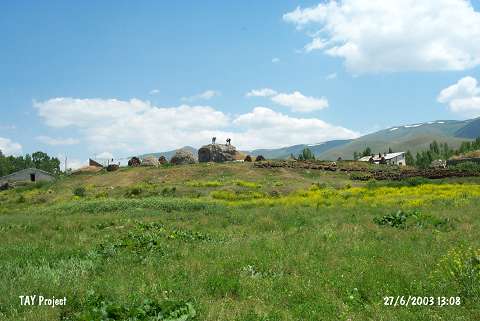 |
|
Type:
|
Mound |
|
Altitude:
|
1780 m |
|
Region:
|
Eastern Anatolia |
|
Province:
|
Erzurum |
|
District:
|
Askale |
|
Village:
|
Ortabahçe |
|
Investigation Method:
|
Survey |
|
Period:
|
|
|
|
|
 |
|
| It is located in Cinis Village (Ortabahçe); south of Kandilli; 40 km west of Erzurum Province. It has been severely damaged just like all the other mounds in the Erzurum Region [Güneri 1992:pic.42-44]. Only a part of it; 8 m in height and 46x50 m in dimensions; stands still. The erection date of the enclosure wall revealed as a result of this destruction is unknown. Except EBA; pottery dating from the second and first millennia BC was collected from the surface [Güneri 1992:160]. It is poor in sherds of the Urartu Period. A well developed example of andirons with a human face was brought to the Erzurum Archaeological Museum. It must be immediately excavated. It takes place in the registered archaeological sites list prepared by Ministry of Culture and Tourism. |
| Location: |
| Geography and Environment: |
| History: |
| Research and Excavation: |
| Stratigraphy: |
| Small Finds: |
| Remains: |
| Interpretation and Dating: |