| ©The Archaeological Settlements of Turkey - TAY Project | ||||||
|
|
||||||
Agziaçik Suyu |
||||||
|
|
||||||
| Ages | Maps | Photos | ||||
| Palaeolithic/Epipalaeolithic |
 |
 |
||||
|
|
||||||
|
Type:
|
Single Findspot | |||||
|
Altitude:
|
m | |||||
|
Diameter:
|
m- Direction: | |||||
|
|
||||||
|
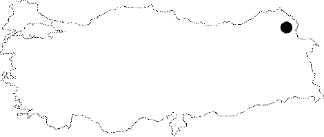
Region:
|
Eastern Anatolia | |||||
|
Province:
|
Kars | |||||
|
District:
|
Susuz | |||||
|
Village:
|
Agziaçik | |||||
|
|
||||||
|
|
||||||
|
|
||||||
|
TAYEx:
|
Not visited - 29/6/2003 | |||||
|
|
||||||
|
Registration State:
|
For detailed registration information please refer to Turkish pages. | |||||
 |
||||||
| Location: This site is north of the city of Kars; on a plain that lies west of the Agziaçik Stream in the village of Agziaçik. This village; also known as Azacik; lies 6-7 km northeast of the town of Susuz. |
| Geography and Environment: The Agziaçik Stream springs from Mount Er and flows south to the east of the village of Agziaçik before it joins the Cilavuz River; which is at a lower elevation. The area is hilly. |
| Destruction Details: |