| ©The Archaeological Settlements of Turkey - TAY Project | ||||||
|
|
||||||
Boztepe |
||||||
|
|
||||||
| Ages | Maps | Photos | ||||
| Chalcolithic IA 14C |
 |
 |
||||
|
|
||||||
|
Type:
|
Mound | |||||
|
Altitude:
|
m | |||||
|
Diameter:
|
m- Direction: | |||||
|
|
||||||
|
Region:
|
Southeastern Anatolia | |||||
|
Province:
|
Diyarbakir | |||||
|
District:
|
Bismil | |||||
|
Village:
|
Merkez | |||||
|
|
||||||
|
|
||||||
|
|
||||||
|
TAYEx:
|
Not visited - | |||||
|
|
||||||
|
Registration State:
|
For detailed registration information please refer to Turkish pages. | |||||
 |
||||||
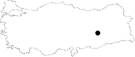
| Location: The site of Boztepe is located 8 km east of the town of Bismil in Diyarbakir Province and just to the south of Bismil-Batman highway. |
| Geography and Environment: Boztepe is a small and low mound. In spite of the fact that in some areas cultural debris measures more than 4 m in depth; its facade against the rolling terrain and neighboring hills makes it almost indistinguishable from the surrounding landscape. Many parts of Boztepe are covered by the remains of a modern village and there is a road on the southeast side of the mound. |
| Destruction Details: |