| ©The Archaeological Settlements of Turkey - TAY Project | ||||||
|
|
||||||
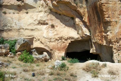
Biçme Magarasi |
||||||
|
|
||||||
| Ages | Maps | Photos | ||||
| Palaeolithic/Epipalaeolithic |
 |
 |
||||
|
|
||||||
|
Type:
|
Cave | |||||
|
Altitude:
|
930 m | |||||
|
Diameter:
|
m- Direction: | |||||
|
|
||||||
|
Region:
|
Southeastern Anatolia | |||||
|
Province:
|
Gaziantep | |||||
|
District:
|
Merkez | |||||
|
Village:
|
Dülük | |||||
|
|
||||||
|
Destruction :
|
Mines/Quarries | |||||
|
|
||||||
|
TAYEx:
|
Visited - 21/8/2001 | |||||
|
|
||||||
|
Registration State:
|
Registered For detailed registration information please refer to Turkish pages. | |||||
 |
||||||
| Location: This cave site lies in the village of Dülük; 11 km north of the city of Gaziantep. |
| Geography and Environment: The dimensions of this cave have not been published (See the site of Dülük for more geological information). |
| Destruction Details: |