| ©The Archaeological Settlements of Turkey - TAY Project | ||||||
|
|
||||||
Beylerbeyi |
||||||
|
|
||||||
| Ages | Maps | Photos | ||||
| Palaeolithic/Epipalaeolithic |
 |
 |
||||
|
|
||||||
|
Type:
|
Single Findspot | |||||
|
Altitude:
|
m | |||||
|
Diameter:
|
m- Direction: | |||||
|
|
||||||
|
Region:
|
Southeastern Anatolia | |||||
|
Province:
|
Gaziantep | |||||
|
District:
|
Merkez | |||||
|
Village:
|
Beylerbeyi | |||||
|
|
||||||
|
|
||||||
|
|
||||||
|
TAYEx:
|
Not visited - 20/8/2001 | |||||
|
|
||||||
|
Registration State:
|
For detailed registration information please refer to Turkish pages. | |||||
 |
||||||
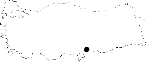
| Location: This site lies in the flat area between the villages of Dülük; 10 km north-northwest of the city of Gaziantep; and Beylerbeyi 7 km north of the same city. |
| Geography and Environment: The village of Beylerbeyi lies in the Gaziantep Plain which is flat with the exception of a occasional rolling hills. Because of the high contents of iron-oxide in the soil; the terrain has a reddish appearance; and the chipped stone finds collected here have a reddish brown patina. The exact location of the site has not been described; thus the exact distances between the site and the surrounding villages cannot be provided. |
| Destruction Details: |