| ©The Archaeological Settlements of Turkey - TAY Project | ||||||
|
|
||||||
Beyköy |
||||||
|
|
||||||
| Ages | Maps | Photos | ||||
| Palaeolithic/Epipalaeolithic |
 |
 |
||||
|
|
||||||
|
Type:
|
Single Findspot | |||||
|
Altitude:
|
820 m | |||||
|
Diameter:
|
m- Direction: | |||||
|
|
||||||
|
Region:
|
Aegean | |||||
|
Province:
|
Kütahya | |||||
|
District:
|
Tavsanli | |||||
|
Village:
|
Beyköy | |||||
|
|
||||||
|
|
||||||
|
|
||||||
|
TAYEx:
|
Visited - 9/10/2000 | |||||
|
|
||||||
|
Registration State:
|
Registered For detailed registration information please refer to Turkish pages. | |||||
 |
||||||
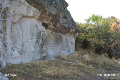
| Location: This site is 3 km northwest of the town of Tavsanli; northwest of the city of Kütahya and west of the village of Beyköy. It lies on a rocky outcrop on the flat area north of it; at the foot of the northern flanks of Mount Manastirtepe; west of the Tavsanli-Domaniç highway. |
| Geography and Environment: The village of Beyköy lies in the flat Tavsanli Plateau along a chain of low mountains oriented southeast-northwest. The find spot is locally known as Asar Tepe. |
| Destruction Details: |