| ©The Archaeological Settlements of Turkey - TAY Project | ||||||
|
|
||||||
Bendersovti Sirt |
||||||
|
|
||||||
| Ages | Maps | Photos | ||||
| Palaeolithic/Epipalaeolithic |
 |
 |
||||
|
|
||||||
|
Type:
|
Habitation Site / Workshop | |||||
|
Altitude:
|
m | |||||
|
Diameter:
|
m- Direction: | |||||
|
|
||||||
|
Region:
|
Southeastern Anatolia | |||||
|
Province:
|
Batman | |||||
|
District:
|
Merkez | |||||
|
Village:
|
Asagi Zileki | |||||
|
|
||||||
|
Destruction :
|
Dams | |||||
|
|
||||||
|
TAYEx:
|
Not visited - 14/9/2001 | |||||
|
|
||||||
|
Registration State:
|
For detailed registration information please refer to Turkish pages. | |||||
 |
||||||
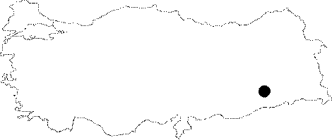
| Location: This site is 11 km southeast of the city of Batman; south of the village of Asagi Zilveki. It is not clear in which village this site lies. |
| Geography and Environment: This site is located west of Mount Raman; on a low terrace which overlooks the valley. The geomorphological setting of this widely scattered site is not described. |
| Destruction Details: Bendersovti Sirt is flooded by Batman Dam reservoir today [TAYEx 10.9.2001]. |