| ©The Archaeological Settlements of Turkey - TAY Project | ||||||
|
|
||||||
Belbasi |
||||||
|
|
||||||
| Ages | Maps | Photos | ||||
| Palaeolithic/Epipalaeolithic Neolithic |
 |
 |
||||
|
|
||||||
|
Type:
|
Rock Shelter | |||||
|
Altitude:
|
300 m | |||||
|
Diameter:
|
m- Direction: | |||||
|
|
||||||
|
Region:
|
Mediterranean | |||||
|
Province:
|
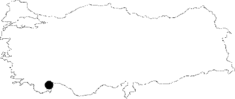
Antalya | |||||
|
District:
|
Kemer | |||||
|
Village:
|
Beldibi | |||||
|
|
||||||
|
|
||||||
|
|
||||||
|
TAYEx:
|
Not visited - 21/6/2001 | |||||
|
|
||||||
|
Registration State:
|
For detailed registration information please refer to Turkish pages. | |||||
 |
||||||
| Location: This site lies approximately 24 km southwest of the city of Antalya; 7-8 km north-northwest of the village of Beldibi (For a more detailed site location description; see Harmankaya-Tanindi 1996: Belbasi) |
| Geography and Environment: The rock shelter; formed in calcareous limestone; was named Belbasi after the closest town (For more detailed geographical information; see Harmankaya-Tanindi 1996: Belbasi). |
| Destruction Details: |