| ©The Archaeological Settlements of Turkey - TAY Project | ||||||
|
|
||||||
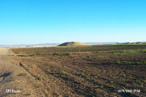
Gre Dimse |
||||||
|
|
||||||
| Ages | Maps | Photos | ||||
| IA |
 |
 |
||||
|
|
||||||
|
Type:
|
Mound | |||||
|
Altitude:
|
500 m | |||||
|
Diameter:
|
m- Direction: | |||||
|
|
||||||
|
Region:
|
Southeastern Anatolia | |||||
|
Province:
|
Diyarbakir | |||||
|
District:
|
Bismil | |||||
|
Village:
|
Köprü | |||||
|
|
||||||
|
Destruction :
|
Natural causes | |||||
|
|
||||||
|
TAYEx:
|
Visited - 10/9/2001 | |||||
|
|
||||||
|
Registration State:
|
Registered For detailed registration information please refer to Turkish pages. | |||||
 |
||||||
| Location: The site is located approximately 1.2 km north of the village of Köprü; east-southeast of Yukarisalat; east of the district of Bismil in the province of Diyarbakir. |
| Geography and Environment: |
| Destruction Details: The skirts of the mound are being damaged due to erosion [TAYEx 10.9.2001]. |