| ©The Archaeological Settlements of Turkey - TAY Project | ||||||
|
|
||||||
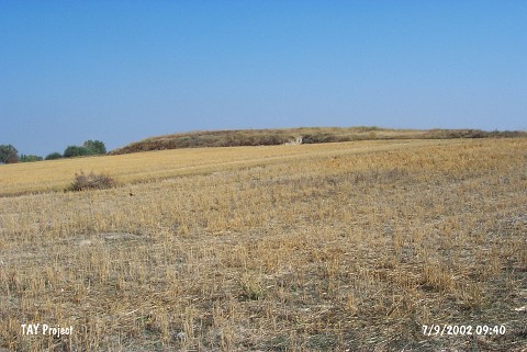
No Name (Aksehir / Karahöyük) |
||||||
|
|
||||||
| Ages | Maps | Photos | ||||
| Other/Unknown |
 |
 |
||||
|
|
||||||
|
Type:
|
Mound | |||||
|
Altitude:
|
1050 m | |||||
|
Diameter:
|
232 m- Direction: N-S | |||||
|
|
||||||
|
Region:
|
Central Anatolia | |||||
|
Province:
|
Konya | |||||
|
District:
|
Aksehir | |||||
|
Village:
|
Karahüyük | |||||
|
|
||||||
|
Destruction :
|
Illicit Digging - Agriculture - Attention | |||||
|
|
||||||
|
TAYEx:
|
Visited - 7/9/2002 | |||||
|
|
||||||
|
Registration State:
|
Registered For detailed registration information please refer to Turkish pages. | |||||
 |
||||||
| Location: |
| Geography and Environment: |
| Destruction Details: The mound has been damaged due to agricultural activities and illicit diggings. All of its skirts have been cut for extending planted areas. There are four pits on top hill [TAYEx 7.9.2002]. |