| ©The Archaeological Settlements of Turkey - TAY Project | ||||||
|
|
||||||
Bastepe |
||||||
|
|
||||||
| Ages | Maps | Photos | ||||
| Chalcolithic EBA |
 |
 |
||||
|
|
||||||
|
Type:
|
Mound | |||||
|
Altitude:
|
32 m | |||||
|
Diameter:
|
m- Direction: | |||||
|
|
||||||
|
Region:
|
Marmara | |||||
|
Province:
|
Çanakkale | |||||
|
District:
|
Eceabat | |||||
|
Village:
|
Yalova | |||||
|
|
||||||
|
Destruction :
|
Agriculture - Attention | |||||
|
|
||||||
|
TAYEx:
|
Visited - 20/6/2000 | |||||
|
|
||||||
|
Registration State:
|
Registered For detailed registration information please refer to Turkish pages. | |||||
 |
||||||
| Location: |
| Geography and Environment: |
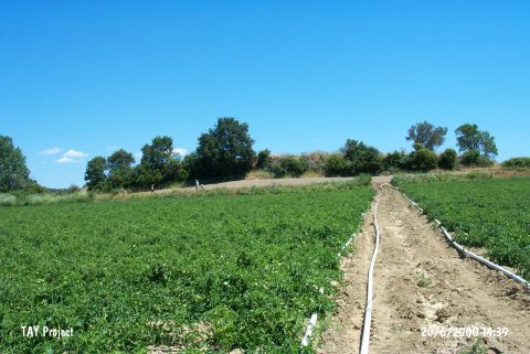
| Destruction Details: Serious destruction caused by intense agriculture was observed. The surface was terraced to make fields; and as a result of this there is a 1 m of elevation difference between two terraces. The stones belonging to architecture were piled on the northeastern skirt. The southeastern foothill was also cut and planted. According to the information taken from the mayor; the mound was previously leveled by the landowner using construction machines and the deposit has lost 3-5 m of its height [TAYEx 20.6.2000]. It was found that the destruction worsened through plantation work on the mound during the researches within the scope of "Gallipoli Peninsula Prehistoric Period Survey" performed by O. Özbek et al. in 2007 [Özbek 2009:372]. |