| ©The Archaeological Settlements of Turkey - TAY Project | ||||||
|
|
||||||
Gökçeoglu |
||||||
|
|
||||||
| Ages | Maps | Photos | ||||
| Other/Unknown |
 |
 |
||||
|
|
||||||
|
Type:
|
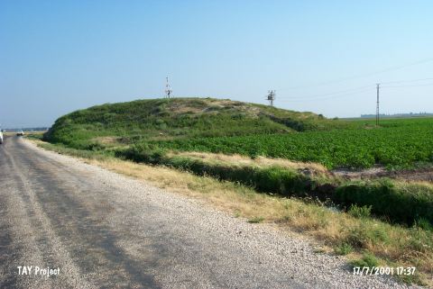
Mound | |||||
|
Altitude:
|
200 m | |||||
|
Diameter:
|
m- Direction: | |||||
|
|
||||||
|
Region:
|
Mediterranean | |||||
|
Province:
|
Hatay | |||||
|
District:
|
Kumlu | |||||
|
Village:
|
Gökçeoglu | |||||
|
|
||||||
|
Destruction :
|
Illicit Digging - Highways, roads, bridges etc. | |||||
|
|
||||||
|
TAYEx:
|
Visited - 17/7/2001 | |||||
|
|
||||||
|
Registration State:
|
For detailed registration information please refer to Turkish pages. | |||||
 |
||||||
| Location: |
| Geography and Environment: |
| Destruction Details: The mound has been damaged due to illicit diggings and due to the road which cuts its eastern skirt. There are two pits on top hill [TAYEx 17.7.2001]. |