|
©The Archaeological Settlements of Turkey - TAY Project
|
|
|
|
|
|
Gökçeoglu |
|
|
For site maps and drawings please click on the picture...  |
For photographs please click on the photo... 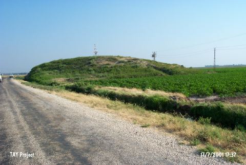 |
|
Type:
|
Mound |
|
Altitude:
|
200 m |
|
Region:
|
Mediterranean |
|
Province:
|
Hatay |
|
District:
|
Kumlu |
|
Village:
|
Gökçeoglu |
|
Investigation Method:
|
Survey |
|
Period:
|
|
|
|
|
 |
|
| It lies in the vicinity of Gökçeoglu Village; east of Kumlu District of Hatay Province. Northwest of he mound passes the road between Kumlu and Reyhanli districts. East of the mound lies the site of Tell Kurcuoglu. The mound was observed during TAYEx 2001 Mediterranean region [TAYEx 17.7.2001]. |
| Location: |
| Geography and Environment: |
| History: |
| Research and Excavation: |
| Stratigraphy: |
| Small Finds: |
| Remains: |
| Interpretation and Dating: |