| ©The Archaeological Settlements of Turkey - TAY Project | ||||||
|
|
||||||
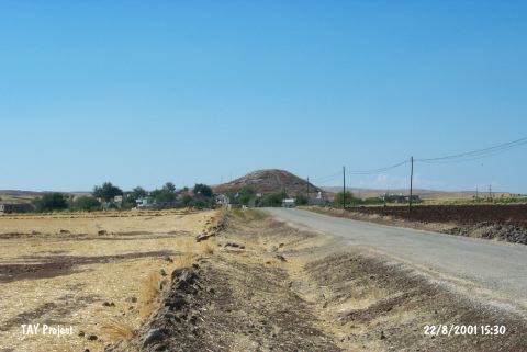
Karamelik |
||||||
|
|
||||||
| Ages | Maps | Photos | ||||
| Chalcolithic EBA |
 |
 |
||||
|
|
||||||
|
Type:
|
Mound | |||||
|
Altitude:
|
750 m | |||||
|
Diameter:
|
m- Direction: | |||||
|
|
||||||
|
Region:
|
Southeastern Anatolia | |||||
|
Province:
|
Kilis | |||||
|
District:
|
Merkez | |||||
|
Village:
|
Karamelik | |||||
|
|
||||||
|
Destruction :
|
Illicit Digging - Natural causes - Contemporary Settlements | |||||
|
|
||||||
|
TAYEx:
|
Visited - 22/8/2001 | |||||
|
|
||||||
|
Registration State:
|
Registered For detailed registration information please refer to Turkish pages. | |||||
 |
||||||
| Location: |
| Geography and Environment: |
| Destruction Details: Soil had been taken from north-northwest slope and middle part of the site. Western section is terraced and built houses. There are pits made by illicit diggers on top. The site is also damaged by erosion [TAYEx 22.8.2001]. |