|
©The Archaeological Settlements of Turkey - TAY Project
|
|
|
|
|
|
Karamelik |
|
|
For site maps and drawings please click on the picture...  |
For photographs please click on the photo... 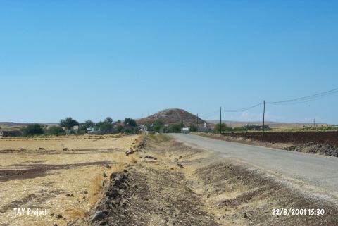 |
|
Type:
|
Mound |
|
Altitude:
|
750 m |
|
Region:
|
Southeastern Anatolia |
|
Province:
|
Kilis |
|
District:
|
Merkez |
|
Village:
|
Karamelik |
|
Investigation Method:
|
Survey |
|
Period:
|
|
|
|
|
 |
|
| The mound is located in Karamelik village of Kilis. Houses belonging to contemporary settlement start from western slope of the mound. It is surrounded by fields. The mound is 125x25 m in dimensions and there is a survey point on top. It was discovered by a team conducted by E. Özgen in 2000. Sherds belong to Late Chalcolithic; EBA and MBA were collected from the mound and basalt foundation stones had been seen. It takes place in the registered archaeological sites list prepared by Ministry of Culture and Tourism. |
| Location: |
| Geography and Environment: |
| History: |
| Research and Excavation: |
| Stratigraphy: |
| Small Finds: |
| Remains: |
| Interpretation and Dating: |